Location Mexico is in North America bordering the United States.

Climate The climate varies according to its topography. Along the coast (on both sides of the country) it is hot and humid, unbearably so in the summer. Inland communities at higher elevations such as Guadalajara (5200 ft above sea level) and in particular close-by Lake Chapala, are much dryer and more temperate.

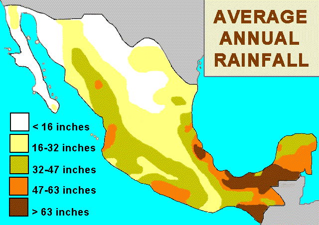
Rainfall The average yearly rainfall in Mexico between the years 2010 and 2014 was 758 millimeters, or 29.84 inches. However, rainfall varies greatly depending on location and elevation above sea level.
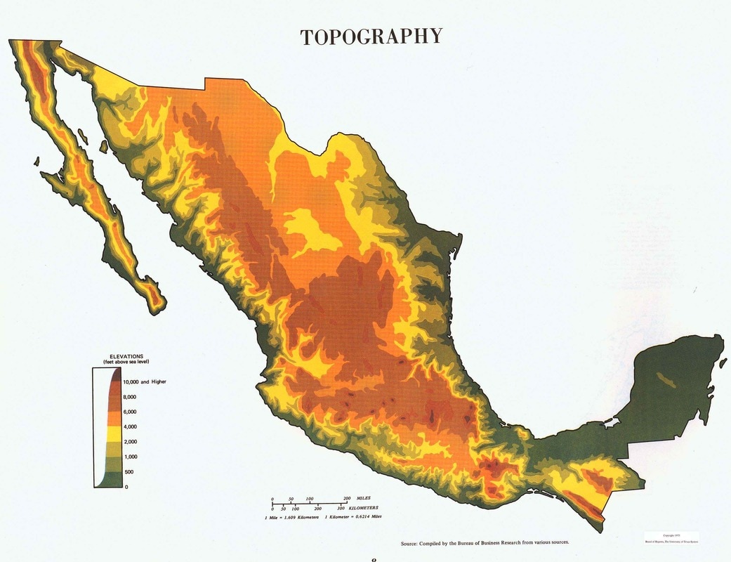
Terrain In the east are the Gulf of Mexico and the Bay of Campeche, which is formed by Mexico's other peninsula, the Yucatán. Almost two-thirds of the country's Terrain consists of mountains and highlands while deserts dominate the north and tropical rain forests are found in the south.
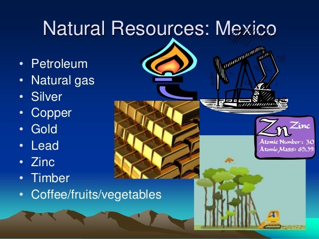
Natural Resources Mexico has large deposits of silver, copper, salt, fluorspar, iron, manganese, sulfur, phosphate, zinc, tungsten, molybdenum, mercury, gold, and gypsum. Petroleum is the country's single most valuable mineral resource.
Location of Cities

Sea Level The sea level varies depending on the place but the sea level is usually very high.

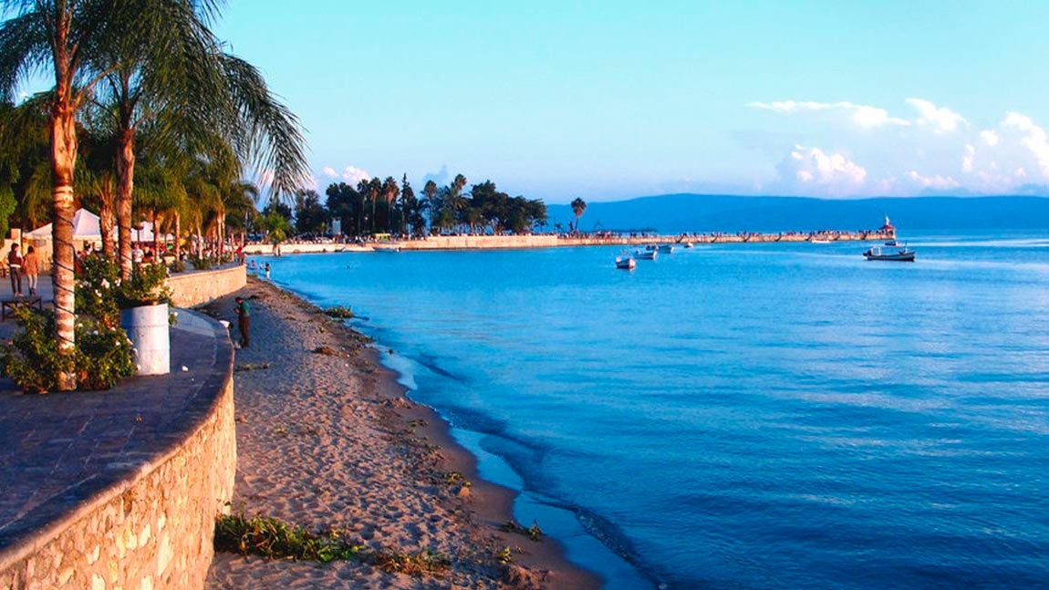
Lakes Lake Chapala is Mexico's largest freshwater lake. It lies in the municipalities of Chapala, Jocotepec, Poncitlán, and Jamay, in Jalisco, and in Venustiano Carranza and Cojumatlán de Régules, in Michoacán. The lakes size is 425 mi².


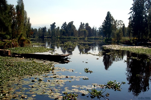
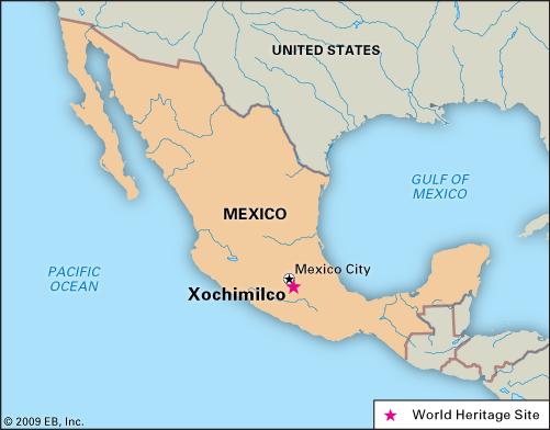
Lake Xochimilco Lake Xochimilco is an ancient endorheic lake, located in the present-day Borough of Xochimilco in southern México City. The lake is within the Valley of Mexico hydrological basin, in central México.
Seas Mexico is bounded to the north by the United States (specifically, from west to east, by California, Arizona, New Mexico, and Texas), to the west and south by the Pacific Ocean, to the east by the Gulf of Mexico, and to the southeast by Belize, Guatemala, and the Caribbean Sea.

Rivers Rio Grande The Rio Grande is one of the principal rivers in the southwest United States and northern Mexico. The Rio Grande begins in south-central Colorado in the United States and flows to the Gulf of Mexico.

Colorado River The Colorado River is one of the principal rivers of the Southwestern United States and northern Mexico. The 1,450-mile-long Colorado River drains an expansive, arid watershed that encompasses parts of seven U.S. and two Mexican states.


Mountains Mexico has many mountains and volcanoes. One volcano is the Pico De Orizaba. It is also known as Citlaltépetl, is a stratovolcano, the highest mountain in Mexico and the third highest in North America, after Denali of the United States and Mount Logan of Canada.

Popocatépetl Popocatépetl is an active volcano, located in the states of Puebla, Mexico, and Morelos, in Central Mexico, and lies in the eastern half of the Trans-Mexican volcanic belt.

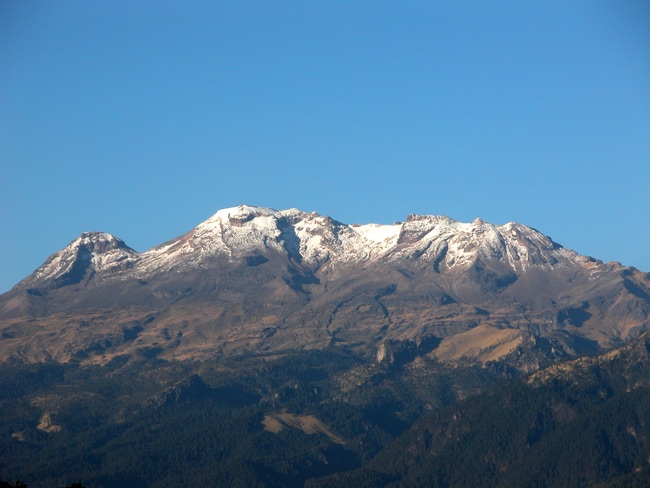
Iztaccihuatl Iztaccíhuatl, is a 5,230 m dormant volcanic mountain in Mexico located on the border between the State of Mexico and Puebla. It is the nation's third highest, after Pico de Orizaba 5,636 m and Popocatépetl 5,426 m.
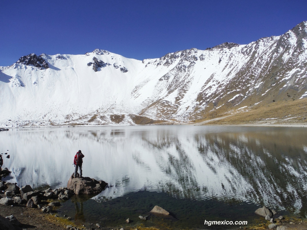
Nevado de Toluca Nevado de Toluca is a large stratovolcano in central Mexico, located about 80 kilometres west of Mexico City near the city of Toluca.